The Charles River
The Charles River flows from Echo Lake in Hopkinton to Boston Harbor. As the river meanders for 80 miles along the much straighter course of the Bostom Marathon, it passes through 23 communities and 33 lakes and ponds, dropping 350 feet before emptying into Boston Harbor and the Atlantic Ocean.
The last 20 miles of the river are a state park, the Charles River Reservation, administered by the Department of Conservation and Recreation (DCR). The Upper Charles River Reservation runs from Riverdale Park in West Roxbury and Dedham to the dam in Watertown. Below the Watertown dam is the Lower Charles River and the Charles River Reservation, 9-1/2 miles of flat water stretching to the Charles River Locks. Lined with boat houses for rowing and sailing, as well as jogging and cycling paths, sport fields, and performance facilities, this is one of the busiest recreational rivers in the world. It is this section of the urban Charles River that is the focus of the Charles River Alliance of Boaters.
The Lower Charles has four major sections: the Upper Basin from the Watertown Dam to Herter Park, the Middle Basin from Herter Park to the BU Bridge, the Lower Basin from the BU Bridge to Science Park, and the New Charles River Basin from Science Park to the Charles River Locks. The Lower Basin is further divided into the Upper Sailing Basin, between the BU and Harvard Bridges, and the Lower Sailing Basin, between the Harvard and the Longfellow Bridges.
An Urban River
Slicing its way between Boston and Cambridge on its way to Boston Harbor and the ocean, the Lower Charles is an urban river, surrounded by a ribbon of parkland. Along the Lower Basin, the Esplanade provides a welcome swath of greenery enjoyed by runners, walkers, and sunbathers alike. On the Fourth of July, several hundred thousand people spread out their picnic blankets on the Esplanade to celebrate Independence Day with a nationally telecast concert by the Boston Pops Orchestra at the Hatch Shell, followed by an impressive fireworks show. A short walk from the river's edge is Fenway Park, our cathedral to baseball and the home of our beloved Red Sox - look for the Citgo sign.
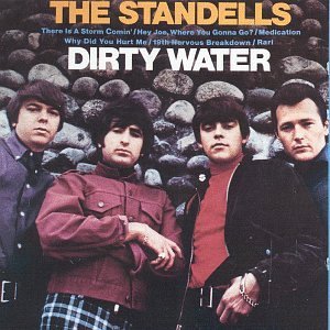
Like many urban rivers, the Charles has a checkered history of past pollution and present-day remediation. Since the founding of Boston and Cambridge in 1630, the Charles has been used to dispose of human and industrial waste. Starting in the 1960s, government and non-profit agencies have worked together to remediate the river and the river is much healthier now. In 1995, the EPA rated the water quality of the river as a 'D', while the most recent rating in 2014 gave the Charles a 'B+', slightly down from its highest grade yet, an 'A-' in 2013. Moreover, the lower basin of the Charles has met EPA swimming standards since 2005 except for a few days a year after large rainstorms. The goal of re-establishing public swimming beaches is now within reach. Even though the water quality is much improved, the boating community that steadfastly continued to use the river though its best and worst years still celebrates its love of that dirty water in a much-sung anthem by The Standells.
A New Chart of the River's Depths
In 2015, CRAB developed a partnership with the MIT Sea Grant College Program to create a detailed chart of the river depth between Science Park and the Watertown Dam. After some initial feasibility studies, more detailed measurements were completed in 2016 and 2017. Both on-line and hardcopy versions of the chart are freely available to the public.